
The contiguous United States had its 14th warmest September on record, according to the latest NOAA State of the Climate report issued today. Average temperatures for September were 67.1 F, which is 1.7 F above the 1901-2000 average. Average precipitation in September was 2.69 inches, 0.21 inches above the 1901-2000 average.
This monthly analysis, based on records dating back to 1895, is prepared by scientists at NOAA’s National Climatic Data Center <http://www.ncdc.noaa.gov> in Asheville, N.C., and is part of the suite of climate services NOAA provides.
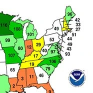
U.S. Temperature Highlights — September
- September was the fourth consecutive month with above-average U.S. temperatures. It followed the fourth warmest summer on record.
- Most states had above-average temperatures, and several others experienced temperatures ranking among their top 10 warmest: Rhode Island (third warmest), New Mexico (fourth), New Jersey (fourth), Colorado (fifth), Massachusetts (sixth), Florida (seventh), Connecticut (seventh), New Hampshire (seventh), Arizona (ninth) and Maine (ninth).
- Regionally, the Southwest climate region experienced its third warmest September on record. Only the East North Central <http://www.ncdc.noaa.gov/temp-and-precip/us-climate-regions.php> climate region had below-normal temperatures.
- An unusual heat wave affected Southern California the last week of September. On Sept. 27, the temperature in downtown Los Angeles reached 113 F, setting an all-time record high temperature for the city. The previous record was 112 F, set in June 1990.
U.S. Temperature Highlights — Year-to-Date
- The nationally averaged temperature for January-September 2010 was 56.9 F, one degree above the long-term mean. While this is only the 21st warmest year-to-date for the nation overall, and the warmest since 2007, individual record-setting temperatures in the regions and a number of states stand out for the period.
- On a regional <http://www.ncdc.noaa.gov/temp-and-precip/us-climate-regions.php> level, the Northeast climate region had its warmest 2010 year-to-date on record at 3.3 F above the long-term mean. Despite having a cool September, the East North Central climate region had its sixth warmest January-September period on record.
- Several states had their warmest January-September on record: Maine, New Hampshire, Vermont, Massachusetts, Rhode Island, Connecticut and New Jersey. In addition, New York, Pennsylvania, Delaware, Virginia, Michigan, Wisconsin and Minnesota had average year-to-date temperatures in their top 10 warmest. Only Florida and Texas had below-normal temperatures for the period.
U.S. Precipitation Highlights — September
- The contiguous U.S. experienced above-average precipitation, although several states had much-below and much-above-normal precipitation.
- Wyoming had its driest September on record with 0.90 inches of precipitation below the long-term mean, Louisiana had its second driest September and Mississippi had its third driest.
- Due to an active weather pattern across the northern tier of the country, the East North Central climate region had its fifth wettest September on record. Many states had much above-normal precipitation during the month, including Minnesota which had its wettest September on record. Among top 10 wettest Septembers: North Dakota (fourth wettest), Wisconsin (ninth), Washington (ninth), South Dakota (10th) and Missouri (10th).
U.S. Precipitation Highlights — Year-to-Date
- Precipitation averaged for the U.S. during the January-September period was 0.90 inches above the long-term mean.
- The East North Central region had its third wettest year-to-date period, while the West North Central region had its ninth wettest such period. The Southeast was the only climate region with below-average precipitation for January-September.
- Many states had precipitation amounts ranking in their top ten wettest for the January-September period: Wisconsin (second wettest), Iowa (second), North Dakota (third), South Dakota (fifth) and Minnesota (seventh). Conversely, Louisiana had its sixth driest January-September.
Other Highlights
- NCDC's Climate Extremes Index (CEI) <http://www.ncdc.noaa.gov/extremes/cei/index.html> for April-September (the “Warm Season”) was about 35, or 15 points higher than the historical average, making it the fourth highest value since 1910. The CEI measures several types of climate extremes like record or near-record warmth, prolonged drought, flooding events, and frequency and intensity of storms like land-falling hurricanes. Factors contributing to the ranking: a large area of the country experienced high temperatures over an unusually large number of days, several areas received heavy rainfall and others experienced worsening drought. For the year-to-date, extremes measured by the CEI were nearly 10 points higher than the historical average of 20.
- \The U.S. Drought Monitor <http://www.ncdc.noaa.gov/temp-and-precip/drought/nadm/> reported 11.1 percent of the United States was affected by drought by Sept. 28. While improvements were seen in the Southern Plains and the Upper Midwest, drought conditions deteriorated during the month in the Lower Mississippi River Valley, along the Gulf Coast and northward along the Eastern seaboard.
Tornado activity across the United States during September was slightly below average. However, two rare tornadoes were confirmed in the New York City metropolitan area.